WTS-NH is excited to welcome Darren Hardy from WSP as our presenter for our next virtual Lunch n' Learn event on August 21st! Darren will provide insight on a variety of surveying tools, including mobile LiDAR, that support surveying efforts across New England.
Wednesday, August 21, 2024
Noon-1 pm
Zoom meeting - for a link to the meeting, please contact Delia Makhetha at [email protected]
1 PDH credit hour is available to all participants!
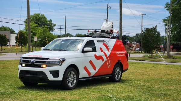
As a survey professional with over 29 years of experience, Darren will share his expertise on multi-source data collection, including Photogrammetry, UAV, Static Scanning, Mobile Lidar, and Traditional Surveys. The presentation will discuss:
- Who compiles all the data into the working product
- How to ensure standards for coordinate systems across a project and procedures for coordinate transformations when confronted with multiple coordinate systems
- Who determines the best available data to use in the final design model
- Distribution and dissemination of information
- Understanding Level of Detail (LOD) in Models
- Using new technology to deliver familiar plans and deliverables
- How to manage large data volumes quickly
- Tools of the laser scanning trade - Software
- Different methods of filtering, clash detection, modeling - Hardware
- Makes, models, different platforms.
- UAV limitations, regulations, and Pros & Cons
- And Why use new technology when the old tech still works
For a link to the upcoming virtual meeting, please contact Delia Makehtha at [email protected].
A bit more about our presenter, Darren Hardy:

Darren Hardy is multiple state licensed survey professional with a survey career that spans more than 29 years, with the last 27 years being with WSP. He has his Bachelor of Science in Survey Engineering from University of New Brunswick. Early in his career he conducted surveys on the Gulf of Mexico including bathymetric surveys and positioning using GPS methods. He has a significant amount of experience in conducting surveys for various transportation agencies throughout the Northeast United States including utilizing terrestrial, aerial and mobile lidar on transportation design projects. He oversees the survey operation at WSP in US and recently has been instrumental with the education and introduction of lidar to transportation agencies demonstrating the benefits of using this technology as a survey tool for design projects. He is a past president of the New Hampshire Land Surveyors Association and Massachusetts Association of Land Surveyors & Civil Engineers.